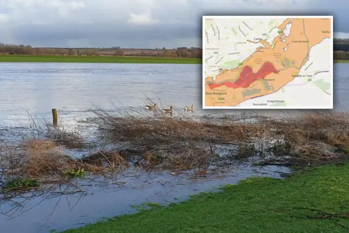
The Environment Agency has issued flood warnings across parts of Gedling borough with nearby properties at risk due to rising water levels from recent heavy rainfall – with the River Trent yet to peak.
There are 20 flood warnings in place across Nottinghamshire. with areas around the River Trent, including Colwick and Clifton Bridge at risk due to rising water levels from recent heavy rainfall.
The guage at Colwick shows the River Trent level is currently at 4.85 metres. When levels exceed 4.5 metres, property flooding is possible.
River levels will remain high until tomorrow, January 9, though no significant further rainfall is expected.
Flooding is expected in the following areas across Notts:
- Holme Pierrepont: National Watersports Centre
- Attenborough Nature Reserve
- Beeston Lock and Marina
- Cavendish Bridge
- Farndon riverside properties, including Dorner Avenue and, Wyke and Marsh Lane
- Fiskerton Mill, including Rolleston Fields, Gorse, and Nurseries
- Gibsmere and Gipsy Lane at Bleasby
- Lenton: Nottingham Park and Ride Site at Queens Drive
- Newark riverside properties, including Tolney Lane and marinas
- Newark Sugar Factory and Kelham Bridge
- Sawley Marina, including Sawley Lock
- Swarkestone
- Thrumpton, including Barton Ferry
- Trentlock
If a flood warning is issued, follow these Government safety recommendations:
- Move your loved ones, pets, and valuables to a safe place.
- Relocate to higher ground or the upper floor of a building.
- Turn off your home’s gas, electricity, and water if it’s safe.
- Follow instructions from emergency services.
- Additionally, avoid using low-lying footpaths near watercourses and never drive through floodwater.
For further advice, contact Floodline at 0345 988 1188.
Stay safe and cautious of river levels in your area.


